Willowick Urban Golf Course Redevelopment

- Project Statement:
The Multi-Disciplinary Group 3 was tasked with working with Fuscoe Engineering to create a conceptual plan on an existing golf course in North Santa Ana. This involves going through multiple public agencies to acquire proper documentation and understand the channels that must be navigated to ensure a timely project schedule.
- Project Description:
The Willowick Golf Course is currently the oldest golf course in Orange County and began operations in 1928. As the years have gone on the generations have aged, the use of the golf course has subsided and the management of the golf course has begun considering design alternatives for the site. The 160-acre golf course is relatively flat and mild Earthwork would need to be done. The location is zoned for mixed-use which would allow for multiple different buildings to be implemented. The revenue is vital to the intent to construct and our group has done three different concept plans which consist of one high-end project, one lower end budgeted project and a do-nothing approach.
- Justification/Rationale:
This site is very unique because in today’s growing world, finding relatively untouched land is becoming increasingly difficult. This is a very distinct infill project because very little demolition will be needed and the zoning is already suited for what we will need. The water table minimum height must be considered because currently, the site sits six feet below the water table and Earthwork will need to raise the site to comply with the OCWD.
- Goals/Objectives:
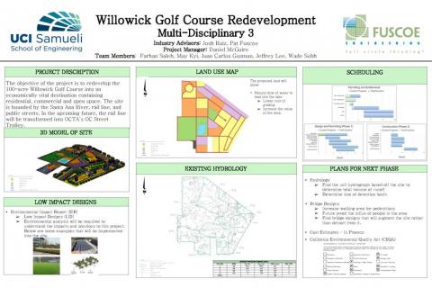
The principle goal will be to renovate the land and include a reasonable cost estimate that will turn a profit for the owners. The site should also comply with current city standards and not stand out too much from the existing conditions. It is our intent with this site plan submittal to create a unique area to follow suit with the Harbor Street Car Project that will run adjacent to our site. The submittal will contain three alternative designs based on population demand and a high density, medium density, and low density option will be submitted. With each density option submitted, a new component will be added in order to make the site more unique. For the highest option of high density, a conceptual plan of high story buildings, around 10 floors, will be designed. For the medium density option, a lake was considered in order to create an “oasis” appeal to Santa Ana. For the low density option, a large nature preserve will be designed to create an open area for the citizens in the city of Santa Ana.
Design Plan
- Description of Site Plan A
Our group, per the advice of the city, has created a mixed-use site plan that will connect with the existing community and not be too abrasively disconnected from its surroundings. The site, as per the design, will incorporate residential zones with commercial spaces in a unique yet, tasteful approach. Site Plan A, as seen in figure 1, includes a dual lake feature which will meander towards the Santa Ana river. This site plan has two unique aspects that make it stand out amongst the other alternatives: the roundabout in the northwest quadrant (pink) and then the lake detention basins. The green zones along the western border are low-density townhomes which will ease the transition from the older development to the new. A medium to large berm will run along the perimeter. The berm will be broken in a few areas along the length which will allow a sense of inclusion. Site plan A includes the largest amount of open recreational space, from waterways (solid blue) to parks and fields (dashed blue).
- Description of Site Plan B
Alternative B is similar to the initial design in keeping with a commercial strip along the border of the site with the streetcar. However, this design varies greatly with the amount of open space it allows. The main portion of recreational land use is accounted for in the implementation of the sports fields in the eastern corner of the site. The design choice was to place the field here so that lends students’ at the Romero-Cruz Academy a stunning view from their side of the river. Site Plan B incorporates more built-up zones for single-family homes (yellow zones). The roundabout from site plan A is removed to introduce a parking lot for the commercial zones.
- Site Plan No Development (“No Dev”)
With Willowick as it is, it serves as a historical landmark for the city of Santa Ana. Willowick showcases itself to be the oldest golf course in the county of Orange. People might have opposition to development on this land and therefore, the No Dev plan has been formulated. No Dev would require Willowick to remain as the golf course in the heart of Santa Ana. The golf course will make less and less money as time goes on. Willowick has not been making the same amount of money for the owners in the last couple years. With the new streetcar being built along the northern perimeter, Willowick will fail to provide a destination for tourists and citizens of the city to travel to. Not only will this affect the owners but also, the city of Santa Ana. One more stop taken off the map could drastically affect the efficiency and popularity of the streetcar. This is the least favorable of the decisions.
- Plans and Upcoming Progress
Willowick deserves a makeover. One that will establish it as a site for tourists, not only from Orange county but from other parts of the state. Santa Ana could use a site like Willowick to push the city into the next part of the city’s life. With the new streetcar coming in the future, Santa Ana will undoubtedly advance greatly. Willowick should too. Therefore, site plans A and B are the main viable options for Willowick to grow.
With updated hydrology studies, the detention basins from site plan A will be moved to the southwestern quadrant. The stream will most likely be terminated on-site near the levy on the eastern side. This decision is driven by the urge to not allow flow into the river to minimize agencies needed to be contacted for this project. Site plan B, should this option be chosen, will have updates as well. The fields will be moved to the southwest quadrant acting as a buffer between the old housing developments and the proposed. Furthermore, the fields will act as a detention basin during rain storms, as well. In both cases, a proposal for the bridge along Fifth Street will need to be moved. The bridge must be expanded due to the limited space for pedestrian movement. Safety comes into question for the residents of the proposed site and the current students at the academy.
Both plans, A and B, will be finalized in a CAD drawing. The CAD will allow the team to tackle the challenges of the site in a more precise fashion. Currently, the main challenges are environmental ones, listed in the EIR/CEQA section.
EIR/CEQA
UCI School of Engineering is working alongside Fuscoe Engineering for the proposed project for Willowick Golf Course. It is the oldest golf course in Orange County dating back to 1928, and provides cheap and affordable golfing to locals of Santa Ana. Currently, Willowick Golf Course is under negotiations from the City of Garden Grove and the City of Santa Ana for redevelopment into a multi-use land that provides commercial, residential, industrial and more to the local community of Santa Ana. This report will show the challenges and project designs that will be implemented to help provide data to understand the impacts and costs of the project. The group along with Fuscoe Engineering must follow the 16 chapters that the City of Santa Ana has established under its General Plan to make this project qualify for development. Some examples include, traffic and circulation element, air quality element, housing element, noise element and more.
- Traffic Impact Analysis
Traffic Impact Analysis (TIA) will be provided for this project to understand how this project will affect local streets along the Willowick Golf Course and the community. Configuring the traffic studies to match the Circulation Plans established by the City of Santa Ana General Plan and improving road conditions and flow to minimize traffic and congestion. Bucknam proposed a few companies that can help with the (TIA) as well. Multiple tests will have to be conducted potential with Caltrans to monitor current street conditions during different times per day for instance.
- Peak-hours a.m. and p.m. during the weekdays
- Saturday peak-hours
- Special events and holidays a.m. and p.m. peak-hours
- Incorporating future inflow and outflow of cars after construction is completed
- Potential study of how the I-5, I-405 and Highway 22 will be affected by increase traffic
- Air Quality and Greenhouse Gas Emissions Analysis
With the design of this project air quality will have to be taken into consideration during construction and added greenhouse gas emissions (GHG) from increase vehicles, power usage and more. By following the South Coast Air Quality Management (SCAQMD), Clean Air Act of 1970, the General Plan from the CIty of Santa Ana and CEQA this project will have to find ways to reduce greenhouse gas emissions and air pollution to provide a safe environment for all to benefit from.
Alternatives will be provided in the design to help lower air pollution and greenhouse gas emissions. Below are some alternatives that will be implemented into the site for tackling this issue.
- Noise Impact Analysis
The General Plan from the City of Santa Ana has standards for noise levels and qualifications that must be followed. Multiple tests will be investigated before the design of this project to see how the current noise levels are and how they will be affected during construction of this project and after the project has been completed. Construction noise levels will have to be monitored and taken into consideration in order to respect the local community surrounding Willowick Golf Course. Future noise impact analysis tests will have to be taken into consideration in order to see how this project will affect current noise levels. Some examples of the project that will create noise such as
- Increase Traffic
- Population increase
- Commercial zones
- Lighting
- Construction process
- Sports parks/schools
Continuing to work alongside Fuscoe Engineering more of the EIR/CEQA will be completed for this project.
Tree Plan
Fuscoe engineering company is committed to building a beautiful environment to the and they assigned us to have a tree plan for the site. Trees contribute a lot to our environment in different ways, they absorb CO2 in the atmosphere and also improve the air quality. It is important that we locate trees in the right places so that they can provide more significant benefits to our community.
The benefit of trees include:
- Trees provide shade and trees can cool the nearby buildings
- Trees increase business traffic
- Trees increase property value
- Trees can block things such as muffle sound from streets and freeways, and also create canopy of green
Hydrology & Drainage
- Completed Hydrology & Drainage tasks
The first task our hydrology team was given by Fuscoe Engineering was to determine the existing conditions of the Willowick Golf Course, the watershed had to be delineated in order to determine where the flow of water would drain during the occurrence of a storm.
Week 2 the hydrology team worked on creating an ArcGIS hydrology delineation map, Figure 8. The map, however, was not very accurate due to the limitations of the available topographical USGS maps used.
Our team walked the site 1/21/20 (Week 3), and among other observations and constraints, we noted consistency and alterations from the site on paper and in person. In particular, we determined the location of two catch basins to be in the lower-left corner of the site, however they were more worn down than expected. Another item we noted was the ribbon gutter located next to the junkyard that takes up a parcel of the site. Lastly, the Top right corner had water flowing in from the neighboring site, however, construction on the OC streetcar removed the storm drain pipe and will be redirecting water away from our site and into the river.
Week 4 after feedback from Fuscoe engineering on our progress, we were provided with a more useful AutoCAD base map to work on our Hydrology delineation.
Our team attempted to use some sort of function in order to automatically delineate the site, though no such function exists. Instead we worked on labeling the catch basins and water flow at the boundaries of the site with the use of the Santa ana Stormwater master plan. As an alternative we started working on the water flow of the site by marking up the physical base map provided by Fuscoe engineering, which came in handy for our current progress.
- Existing Hydrology
Week 5 kicked off the extent of our current progress, the first step was to determine the major ridges on the site by observing the topography and marking up a Physical map of the site with Fuscoe engineering. Based on the contour lines of the golf course and the ArcGIS delineation map (Figure 8), it was initially assumed the water would drain towards the bottom left, where the elevations are low. After dividing the site into subareas, the major flow lines of the site were observed. These flow lines would start from a high elevation of 90 feet and drain towards the lower elevation of the site, which was about 78 feet. The three different lengths of the flowlines were determined to be 1,975 feet, 2,656 feet, and 1,397 feet. Once the flow lines were drawn, 300 feet was measured for the initial run of the drainage course, where another subarea was created. After the initial 300 feet, the rest of the area was equally divided. Table 1 summarizes the information needed to perform a hydrology calculation. and Figure 9 is our resulting Hydrology Plan autoCAD file.
- Hydrology and Drainage to be completed
The next step once filling Table 1 is to use the data from the table to determine the existing runoff (Q) of the site and once completing our development plan we will also calculate the Theoretical Q.
These values are found in order to calculate the difference in run off so that we incorporate some sort of mitigation into our design. We know the change in Q will be large due to going from grass to buildings (concrete) which does not infiltrate as much water.
As a result, mitigation efforts are to be taken. Efforts such as adding a larger drainage pipe or adding parallel pipes that run into the river. However, this cannot be our only plan of action, since the river is run by the county and the flow coming out of our site cannot exceed a certain amount due to river line that cannot be exceeded for 100yr storm mark.
So another option to add is a retention basin, but also make sure it looks beautiful, such as a lake or a soccer field. As of now our Plans and alternatives include a retention basin, however the location of the basin will be limited to the path of the water flow we found, so some changes are to be taken.
References
https://earthtechling.com/2011/04/rooftop-solar-tops-college-parking-garage/